Weather and climate information services are one of the prerequisites for building resilience to climate change at the local government and community level. For regional decision makers, climate information needs to be a strong scientific base in planning and taking medium and long-term development decisions.
For example, information on climate change projections can show an increase in the average temperature of the earth in the next 30-50 years and can produce derivative information in the form of changes in rainfall patterns and temperatures that vary in various places and times. However, the analysis of the effects of climate change is not a simple and easy thing. The increasing trend in the temperature of the world average does not necessarily increase the temperature in a region in a certain period of time. The impact of climate change varies greatly in each region with a different time frame. Because the earth is a complex system between atmospheric, geophysical, biophysical, oceanic and of course, anthropogenic. From variations and trends in the pattern of changes in rainfall and temperature, further impact studies need to be carried out for several strategic fields such as the impact of increasing the risk of hydro-meteorological disasters (floods, landslides, droughts, etc.), agriculture, fisheries, clean water, etc. This will be more useful when translated into a more sectoral policy.
At the national level, the USAID APIK Program also supports the preparation of policy brief on climate change projections for the Indonesian region in order to strengthen the National Action Plan on Adaptation to Climate Change (RAN-API). At the sub-national (regional) level, USAID APIK conducted a series of Vulnerability Assessment activities carried out in three provinces, three different landscapes, and 12 cities / districts in the APIK working area. To complete the scientific base of climate change projections in the eastern region, USAID APIK together with the Bandung Institute of Technology (ITB) also assisted the BMKG in carrying out downscaling the Climate Change Projection for the Maluku region. The results of the derivative analysis of the product can be used as a tools that can be used by the local governments in making medium and long term decisions, especially in Maluku Province.
Climate services are not merely talking about projected information for the next 30-40 years. No less important in anticipating the impact of climate change is how to respond to climate variability that has a shorter time frame. The BMKG divides the criteria for climate information starting from 10 days (dasarian), monthly, 3 monthly, and prospects for the next 6 months including regional and global climate forcing such as El-Nino / La-Nina, Monsoon, Dipole Mode, ITCZ, etc. which is also in that time frame.
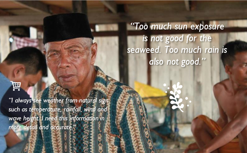
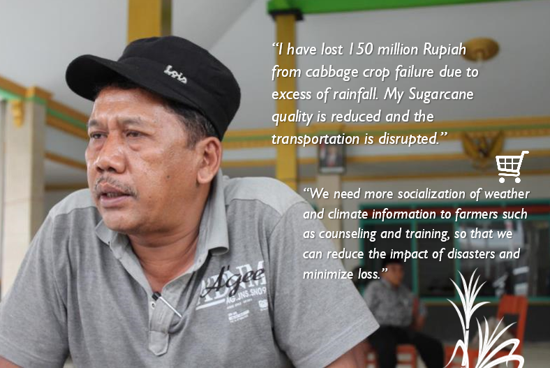
The World Meteorological Organization categorizes the Global Framework for Climate Services into five priority sectors, namely: 1) agriculture and food security; 2) disaster risk reduction; 3) energy; 4) health; and 5) water. At the level of governance and improving community resilience, the question now is, has the Agriculture Agency or the Food Security Service at the regional leval made use of Climate prediction information to estimate how much rain needed to meet the needs of rain-fed farming? Or how consistent is the supply of water from a nearby spring or river source to irrigate agriculture that relies on irrigation networks as a main source of water. Can Sugar Cane Farmers in Wonokerto Village, Malang Regency be able to access and utilize climate prediction information for the next one to three months to determine planting time and hatchery activities? Has the Health Office in Malang City made use of the basic predictions to anticipate the supply of medical supplies and the readiness of hospitals to accommodate dengue fever patients?
The Weather Service has a shorter time frame starting from minutes, hours, daily, 3-day to weekly prospects. Almost all sectors and individuals are beneficiaries of good weather information for a motorcyclist in Malang City to fishermen in the Arafuru sea. For some people, weather information is a life and death decision as when fishermen need to know information about winds that form wave heights in the ocean. For small medium enterprises, the rain or not rain is profit or loss. You can ask the salt farmers, nutmeg farmers or crackers factory who need sunlight to dry their products.
In the context of climate change adaptation, weather literacy and climate are things that cannot be separated. If you are a pedestrian, do you bring an umbrella during the rainy season? Regardless you are an urban community that can take shelter when it rains at bus stops, it will be more effective during rainy day if we can still continue to walk by using an umbrella or raincoat, because for urban people, time is money. Thus, the daily weather forecast information encouraging you to take adaptation action (carrying an umbrella) to adapted with the situation. Another example is if there is a group of farmers who are aware that rainfall patterns in their rice fields have shifted from year to year, the local Food Crop Research Institute needs to provide adaptation option such as developing new varieties that are suitable for climate conditions in the region or innovate more irrigation technology in efficient and effective manner.
The further question now is whether every layer of society is aware that this information is available? Do they want and can access the information? in what form should they receive the information? And can they digest the information and make it a consideration in planning daily activities?
At least, for now, in 3 Provinces and 12 Cities / Districts where USAID APIK works, this has been analyzed in detail and described in the Weather and Climate Information Service Assessment Report. The report, published at the beginning of 2017, reported weather and climate service conditions from upstream to downstream involving BMKG and various institutions at the national and regional levels, and 384 respondents in 71 villages and sub-districts. The report concluded that at least the problems related to weather and climate information services are in the following four phases: 1) data collection; 2) product development and packaging; 3) information dissemination; and 4) utilization. The report was then followed up with the formulation of the Climate and Weather Information Services Roadmap that was used as a guide for USAID APIK in strengthening these services in the next 4 years.
The Challenges
History records that the observations of meteorology and geophysics in Indonesia starting in 1841 began with observations carried out individually by Dr. Onnen, Head of Hospital in Bogor. Through the Historical Data Digitization program (DiDaH), in 2009 the Dutch government assisted the Indonesian government in collecting and managing climatological data, which at the time were still many in the form of hardcopy report sheets from colonial times to the days of independence (1850-1960). In the same year, BMKG formed a Database Center and produced several data sets per station / rain post, as well as a DataGrid set that could fill in the data gaps at the location point where there were no stations / observation posts. In the current era of information technology, the process of collecting data has a challenge in transforming manual methods into automatic ones. In the East Java area, for example, from around 1000 manual rain posts scattered, only about 190 posts effectively send rainfall data to the Malang climatology station every ten days. At present the number of Automatic Weather Station (AWS) or Automatic Rain Gauge (ARG) in the territory of Indonesia is still very limited. In fact, topographic factors, landscapes and land cover greatly influence the distribution of rainfall in an area so that the density of stations / rainfall posts becomes crucial in determining the quality of forecasts.
The challenge is increasingly found in eastern Indonesia such as Maluku, where the location of rainfall posts is scattered on separate islands, making maintenance costs high. Southeast Sulawesi Province has its own challenges considering the Ranomeeto Konawe Selatan Climatology Station was officially established in early 2017. Previously, all posts and stations in the Southeast Sulawesi region were still managed by Maros Station at South Sulawesi and the Kendari Maritime Meteorology Station . In addition to the lack of a number of observation points in the field, this Station is also still lacking in the number of human resources, which hampers the operations in managing infrastructure, observations, producing information, and dissemination.
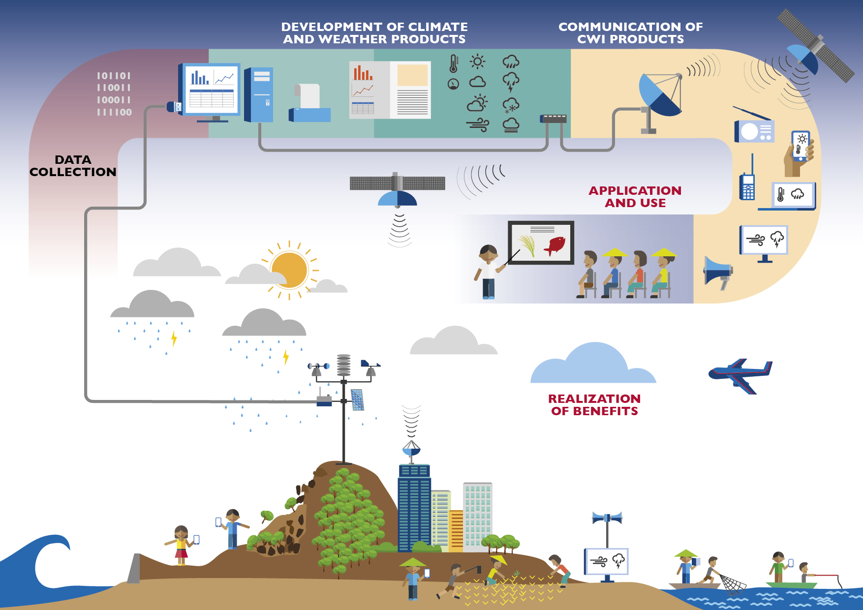
In terms of product development and packaging, information produced by BMKG is sometimes still made with the viewpoint of users at the national level. Some products cannot yet represent the beneficiaries at the field level (e.g. farmers). USAID APIK and BMKG try to build the product that is based on the end user needs at the grass-root (community) level with limited literacy and access mode. The objective is to see what the real market wants or needs. In addition to the information needed, we must be able to see the conditions of the beneficiaries in a comprehensive manner. How far is the user’s understanding of weather and climate information? Can the person read and digest the information? is it color blind? is the cellphone signal available? etc.
USAID APIK understands that BMKG is required to provide services that can be used by all Indonesian people from Sabang to Merauke. with limited funds and time, BMKG is required to determine which activities should be prioritized to be improved. Thus, USAID APIK seeks to help fill the gap, taking the perspective of end users with a bottom-up approach. The challenge for USAID APIK is how people who are in extreme conditions with no weather and climate literacy are qualified, do not have a stable mode of access to information, can still use weather and climate information for their daily lives.
The Progress
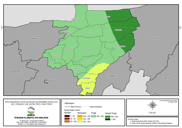
In 2017, together with the Climate Change Information Center and the BMKG Communication Network Center, we completed the development of ‘Otoklim’ tools that are useful for assisting BMKG Office in the regions in producing climate analysis and prediction maps util the village level and disseminating them through the BMKG Provincial website (East Java, Southeast Sulawesi & Maluku). This is done to fill the gap so that farmers can directly access BMKG information without having to wait the information sent by the Agriculture Extension. This is where APIK also began to open access to information dissemination.
The three basic products, namely the downscaling of climate change projections for Maluku region, Otoklim and the BMKG Provincial Website are USAID APIK’s initial steps in strengthening weather and climate information services. There are still seven other systems / products / services that need to be defined and built/strengthened. With a target of 4000 trained people in utilizing weather and climate information or carrying out disaster risk reduction actions, APIK also strengthens BMKG programs that aimed at increasing the use of weather and climate information. The Climate Field School Program (CFS) is one example of a program that is routinely budgeted by BMKG in supporting the improvement of community climate literacy, especially in the agricultural sector. The BMKG is aware that the existing CFS format requires large costs and a long time to reach all agricultural communities in Indonesia. With these limitations, the challenge for USAID APIK and BMKG is to develop the CFS model and other forms of strengthening weather & climate literacy that can be replicated and budgeted by the local government including conduct the Training of Trainer for local agriculture extension.
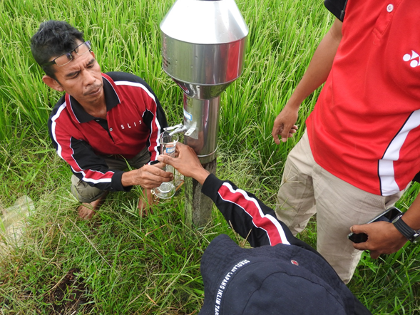
In 2017, APIK assisted the Konawe Selatan Climatology Station in implementing the 2nd stage of Climate Field School (Training of Trainers for Staff & Extension of the Agriculture Service) and the 3rd stage (CFS at the community level) held in Baruga Village, Kendari City. Some pilot training programs are also carried out with different themes for different targets such as fishermen, school children, students, MSMEs, or disaster volunteers. Thus, over time, each training activity will be evaluated and used to refine the tools that are expected to be replicated elsewhere, and even proposed to be a superior program so that it is budgeted by the local government.

