Climate and weather information (CWI) services are used by a wide range of actors in Indonesia—public, private, and civil society—to fulfill specific, placed-based needs, from maximizing crop yields to navigating coastal waters to warning communities of impending flood risk. Recent advances in technology enable meteorologists to capture larger quantities of more precise weather data, while community leaders, farmers, and fisher folk increasingly have access to that data via mobile connectivity. Nevertheless, the CWI services marketplace remains quite fragmented with varying levels of coordination along the ‘value chain’ of service provision that collects raw data and translates it into useful information for beneficiaries.
Through the Climate and Weather Information Services Assessment, USAID’s Adaptasi Perubahan Iklim dan Ketangguhan (APIK) Project catalogues the existing actors, data, products, and users of CWI services in Indonesia with the aim of identifying key gaps in the marketplace. Detail from this Assessment report will then inform the forthcoming APIK CWI Services Roadmap, which will analyze specific CWI value chains within APIK’s priority regions and inform the Project’s technical assistance entry-points over the coming four years.
Assessment Approach & Method
Broadly speaking, climate and weather information services consist of the hardware (sensor networks, weather station infrastructure, and IT equipment), software (trained staff, recognized communication and dissemination platforms, local awareness) and the supporting institutional arrangements (codified roles and responsibilities, data sharing policies, dedicated funding) that facilitate the systematic collection, analysis, packaging, communication, and use of meteorological, hydrological, and climate data. Robust CWI services are integral to Indonesia’s National Action Plan on Climate Change Adaptation (RAN-API) in the context of hydro-meteorological disaster risk reduction and development planning. At the international level, the World Meteorological Organization (WMO) also recognized the critical role of improved climate services, establishing the Global Framework for Climate Services in 2012 as a worldwide mechanism for coordinated actions to enhance the quality, quantity, and application of climate services (see http://www.wmo.int/gfcs/).
Climate and weather information services are most impactful when an active process is put in place to transform raw environmental observations into actionable information communicated to the right people at the right time. Toward this end, the APIK assessment team used the concept of a climate and weather information value chain to frame the institutional roles and action steps required in the transformation of data into decisions. These steps are: (1) raw data collection and organization, (2) product development, (3) communication and dissemination, (4) application and use, and (5) benefit realization. The notion of climate and weather information services as a value chain operating in the context of a local market allows us to: identify and segment the key climate and weather services actors; define the roles that such actors play across all the links of the value chain; connect those that collect and produce CWI services (the “supply side”) and those that apply them at the local level (the “demand side”); and detect specific gaps or weaknesses in the value chain and target technical assistance efforts accordingly.
Regarding methodology, the CWI Services Assessment was completed over a period of approximately eight months, from April through November of 2016. The APIK assessment team engaged in consultations with national level actors (i.e. top-down) as well as a wide range of stakeholders at the subnational and community levels (i.e. bottom-up) in APIK’s priority provinces of East Java, Southeast Sulawesi, and Maluku. The team principally used structured, key informant interviews as well as focus group discussions (FGDs) across all levels to gather inputs and perspectives. The results of this intensive stakeholder engagement process were then synthesized by the APIK assessment team and compiled in the full report, which details the current status of the actors, data, and products along the value chain. The concluding chapter of the report then provides a summary analysis of services gaps identified by the APIK assessment team at each step of the value chain, including those at the national and subnational levels, in the public and private sectors, as well as at the community level.
Key CWI Institutions, Products and Communication Modes
The institutional landscape of climate and weather information services is, not surprisingly, dominated by the National Meteorological and Climate Agency (BMKG). According to prevailing government regulations, BMKG represents the primary collector of climate and weather data and producer of tailored climate products. More specifically, Presidential Decree No. 61 of 2008 states that the Agency is obligated to conduct governmental tasks in the field of meteorology, climatology and geophysics, including, but not limited to data collection and management, analysis and delivery of weather and climate change information to public and private stakeholders at both the national and subnational levels, communication of disaster warnings to relevant institutions and agencies, and the implementation of research and development. To fulfill these mandates, BMKG operates 122 meteorology stations, 31 geophysics stations, and 21 climatology stations across the archipelago.
A wide variety of public and private organizations play targeted, supporting roles in the climate and weather information services landscape. The National Disaster Management Agency (BNPB) represents an important producer and communicator of disaster preparedness and response products accompanied by broad reach through Local Government Disaster Management Authorities (BPBDs). National planning and technical ministries play a role in translating climate and weather data into specific sectors; the Ministry of Agriculture, for example, helps farmers to apply climate information to maximize crop yields, while the Ministry of Public Works and Housing works across administrative boundaries to manage water resources within a given drainage basin.
The CWI institutional landscape extends well outside the public sector, however, to include research organizations (e.g. universities), media entities (e.g. television stations, radio, and print media), as well as commercial entities. While most of these are engaged in the communication and use of climate and weather products, some also collect their own observations directly. The Weather and Climate Prediction Laboratory at the Bandung Institute of Technology, for example, collects and publishes its own weather data using local instrumentation.
The array of CWI institutional actors currently develop and disseminate a diverse portfolio of climate and weather information products, some for internal use only and others available to the public. Notable products and systems commonly referenced during assessment interviews included:
- Daily and weekly weather forecasts collectively generated by BMKG Stations and Head Office, as well as seasonal climate predictions;
- Downscaled climate change projections for temperature and precipitation change with a resolution of four square kilometers, also generated by BMKG;
Vulnerability Inventory Index Information System (SIDIK) and the Early Warning System for Forest and Land (Sipongi), both of which are managed by the Ministry of the Environment and Forestry (KLHK); - Landslide Early Warning System, InAWARE (a Disaster Preparedness and Response Platform), and the Disaster Risk Map, all of which fall under the Disaster Management Authority (BNPB);
- The Integrated Planting Calendar (KATAM) and Resilience and Food Security Maps promulgated by the Ministry of Agriculture;
- Disaster Mitigation, Adaptation & Environmental Information System (SIMAIL) that supports coastal communities and is managed by the Ministry of Fisheries (KKP);
- Hydrology, Hydrometeorology and Hydrogeology Information System (SIH3) coordinated by BMKG with the Ministry of Public Works & Housing and the Ministry of Minerals and Geologic Resources;
- Bandung Metropolitan Early Warning System (ITB); and
- Flood Forecasting & Warning System (FFWS) and Flood Early Warning and Early Action System (FEWEAS) established and operated by Perum. Jasa Tirta.
The modes of communication and dissemination of climate and weather information services are equally diverse, and include internet sites, social media (specifically Twitter, Facebook, and WhatsApp) print media, televised broadcasts, national and local radio programs, smartphone applications, and short message services (SMS). In a country well known for its rapid uptake of social media and digital technology, it is noteworthy that, based on APIK’s interviews, digital communications do not necessarily translate well to more rural communities. In communities in Southeast Sulawesi and Maluku, for example, many informants reported that they obtain climate and weather information from television, word of mouth, or loud speakers (in the case of emergencies).
Summary of Findings across the Value Chain
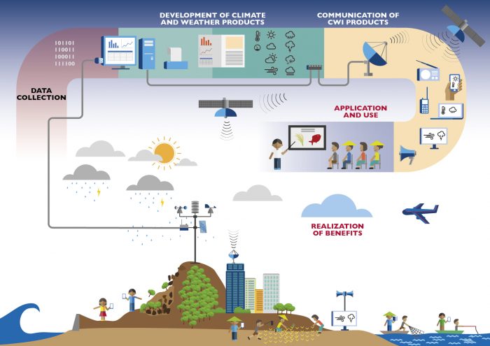
Based on more than 650 individual interviews including representatives from 11 national government agencies, 152 local government agencies across cities and districts in 3 provinces, 61 businesses, representatives from media and research institutions and community members from over 70 villages, the following summarizes the key findings of the CWI Services Assessment across the stages of the value chain:
Data Collection & Processing:
While BMKG has (and continues to make) investments in the reliable collection of observational data, significant spatial and temporal gaps persist. The instrumentation necessary to collect climate data with a sufficiently high spatial and temporal resolution is not yet established in many places, but especially in the more remote areas outside of the Island of Java. Further, where instrumentation was set up, a lack of standardized/automated collection methodologies and maintenance greatly impact the quality and utility of the data. For example, 992 manually operated rain gauges in East Java require staff to visit them daily and record data in a log book, which then must be summarized and sent monthly to the irrigation office, where it is then compiled and distributed via email to BMKG. A lengthy manual process like this contributes to poor data quality – as does the fact that many of the gauges no longer function properly.
A lack of open data policies continues to inhibit the sharing of climate information, inhibiting warning systems, the improvement of models, and the proliferation of climate research. The APIK assessment team found that, at present, climate and weather data collectors tend to focus on the gathering of environmental data in accordance with their own needs, failing to recognize that other producers, communicators, and users may have related yet distinct information needs that can only be fulfilled if the raw data is maintained in a specific format and is of sufficient granularity (i.e. spatial and temporal resolution).
Even when data is in the public domain, important gaps often exist and platforms to access those datasets are not always reliable. From the perspective of data needs, APIK found that historical weather data sets are typically the most in demand, but that the completeness of those data sets is an important area of improvement for BMKG. That said, the majority of users surveyed report being satisfied with the available data types, such as ENSO, Sea Surface Temperature (SST), Extreme Climate, Flood Potential, Water Balance, Days without Rainfall, and Season & Climate Prediction.
The assessment team also found that most CWI data users access the information through inter-ministerial/agency correspondence. The agencies themselves often access the data through sending a formal request letter to BMKG. While much of BMKG’s data can be accessed directly through the website, most people interviewed stated the website functionality needs improvement. The CWIS users from BNPB also highlighted a clear need for better integration between platforms, such as connecting the Multi Hazard Early Warning system with radar data to enhance its reliability.
Product Development:
Like many climate and weather marketplaces around the world, product development in Indonesia is supply-driven, lacking a clear focus on the needs of users and beneficiaries. The needs of the data collection institution often shape product development. For example, wave height maps are often disseminated in low-resolution format, making it difficult for fisherman to discern the conditions in local waters. Similarly, technical jargon used by government officials frustrates public users, who in reality must play the role of ‘product developer’ to actually analyze and use CWI data sets. Given most local government survey respondents shared their unhappiness with community use of CWI data, a considerable opportunity exists to connect users and producers for product development purposes. In this regard, APIK did not find any widely used feedback mechanisms in which users and producers interact to help improve existing products.
Notably, most institutional products focus on early warning for disaster risk reduction purposes, while very few incorporate climate adaptation concerns such as shifts in seasonality. This is due in part to product demand as well as data gaps – for example, manual rain gauges do not capture one of the most anticipated changes in local climate, namely, the hourly intensity of rainfall.
One of the main challenges for CWIS across the different landscapes is that each area has its own risk characteristics depending on the local context and issues. From the watershed point of view, at the upstream level the main issues include land use change and water scarcity coupled with landslides or flash flood threats. In cities, the common issue is urban flooding, with mismanaged rivers and drainage systems increasing the risk. Coastal flooding, erosion, and sea level rise are threatening seaside communities, and land use decisions can exacerbate those risks, as seen with the Bajo people who traditionally build houses above the coastal sea water. For some coastal areas, especially those downstream from big rivers, there is greater risk of landslides and flash flooding. Therefore, in order to ensure local needs are met, CWIS must be contextualized and relevant for each area. There is no “one size fits all” solution.
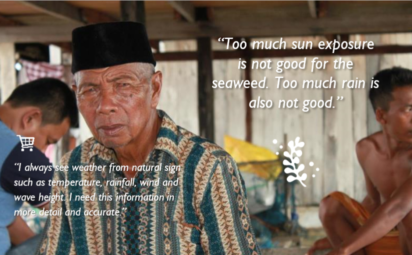
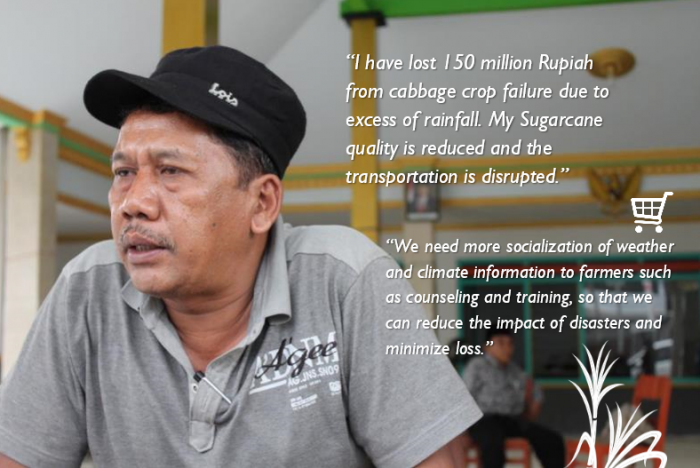
The assessment results show that climate variability is affecting community livelihoods, especially those relying on natural resources. Many farmers face common issues, such as difficulty determining the beginning of the rainy season, which impacts when to plant their crops and how to manage pest control in different and varied weather conditions. In some places there are also water shortage issues, especially during the dry season for rain fed paddy fields. For coastal communities, the weather uncertainty shortens the time fisher folk spend at sea and limits their sailing distance.
In the tourism sector, weather uncertainty and the strength of El-Nino/La-Nina has proven to disrupt operational activities. For example, local marine tourism has been impacted by dive site coral bleaching issues due to increasing sea water temperature. Agro-tourism is also affected by climate change as well, since the activity is dependent on agricultural products to draw tourists to a region.
Dissemination and Communication:
Local TV and radio are the primary channels people use to access timely weather information, although digital communication modes are playing an increasing role in some areas. Communities with limited access to smartphones or the internet rely heavily on traditional media (through daily weather forecasts or special announcements for extreme weather events on television, radio or amateur radio broadcast) and often disseminate weather information verbally through group or village meetings. In Southeast Sulawesi and Maluku, wave height information is an important data point that is routinely broadcast by the local media. Informal, community-based radio is especially useful in fishing communities.
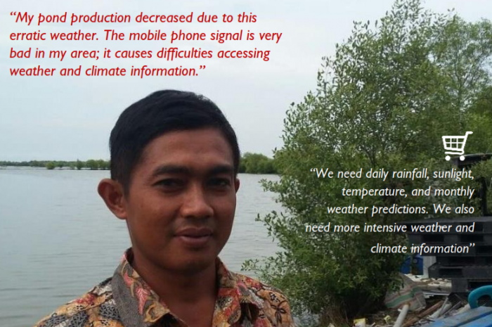
That said, digital communications are on the rise. BMKG and BPBD, for example, both use social media to disseminate CWI messages, with Twitter being the most popular tool. Some remote communities receive climate and weather information through SMS (short messaging service), but this is highly dependent on signal strength and thus it is generally not on a regular basis. Further, instant message groups have become increasingly popular at the local government level as well, often used to exchange weather information among staff at SKPDs (local government departments). Information that can be displayed is quite comprehensive, ranging from text, images and links to websites. Again, however, this mode is only available in areas with an affordable and strong mobile internet signal (GPRS, HSDPA, etc.).
Local staff and volunteers represent a critical link in communicating climate and weather information at the community level. APIK found that local actors such as agricultural extension officers, disaster coordinators, and BPBD volunteers play a fundamental role in disseminating climate and weather information at the grassroots level. Such individuals are interacting with potential users and beneficiaries on a daily basis, and are able to take sometimes complex CWI products and translate them in a manner that is meaningful to farmers and fishermen. Some disaster coordinators have also started their own instant messaging groups among them to exchange early warning information.
CWI dissemination is not just about posting data and products, but requires targeted marketing and capacity building. CWI users are ultimately “consumers”, meaning that they have choices on whether to use a product or not. First and foremost, they need to be aware what products exist through active marketing that targets specific segments of the climate and weather information marketplace. Also, users must feel comfortable with the product and be convinced of its usefulness. Notably, APIK encountered several existing government programs that aim to enhance the capacity of the public to apply climate services, including the Climate Field School program, PKPT / PDPT, Indonesia Coastal School, Agricultural Extension and Fishermen, and Proklim. Unfortunately, these have not reached scale – for example, Climate Field School Stage 3 for farmers covers less than 10% of the total villages in APIK regions (East Java, SE Sulawesi, Maluku), and the same program for fisher folk has not yet reached the village level based on our assessment.
The lack of marketing and familiarity with climate services also impacts local government uptake. For example, the Livestock Agency in Malang District stated that they never obtain regular CWI from BMKG; instead, they rely on historical knowledge concerning the seasons or television broadcasts. Similarly, the SIDIK system on climate vulnerability, a derivative product of KLHK, represents an example of a product that has not been socialized properly in with the local BAPPEDA.
Application and Use:
Existing climate and weather products struggle to reach the “last mile” of beneficiaries, often failing to make it to the communities and households where they are most needed. Many communities facing climate change risks are not yet using the climate and weather services produced by national authorities. Various ministries have produced climate and weather information products, such as the Disaster Mitigation, Climate Change & Environmental Information System (SIMAIL) run by the Ministry of Maritime Affairs and Fisheries, the Kalender Tanam Terpadu (KATAM) planting calendar produced by the Ministry of Agriculture, and BMKG’s monthly rainfall analysis. All of these tools could be of considerable benefit were they to reach intended users. Unfortunately, none are being used at scale by farmers and fisher folk; this assessment found only two respondents familiar with KATAM and two others who had heard of the SIMAIL product. Similarly, many local governments are still not optimally utilizing services to inform programs or strategic planning. Such difficulties with “last mile” service delivery are a common challenge for climate and weather information services, which reflects the importance of the aforementioned emphasis on marketing and capacity building.
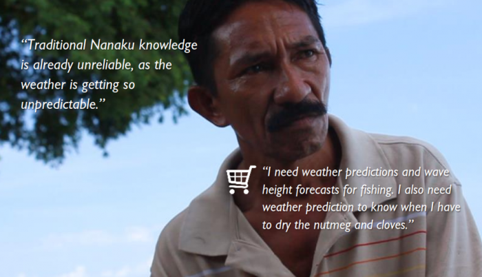
Many stakeholders continue to rely on personal observations and traditional climate knowledge, especially when more “formal” climate services are not available. Most of the communities visited by APIK continue to use their own indigenous knowledge for predicting weather and seasonality rather than accessing formal services produced by BMKG. While traditional methods such as Nanaku or Pranata Mangsa (traditional seasonal calendar) have been used for centuries, many respondents admit that these methods are not entirely reliable. Further, the long-standing “DJF-JJA-rule” (i.e. monsoonal pattern) that many farmers have relied upon appears less and less consistent. It is especially difficult to predict the onset and potential impacts of the La-Nina and El-Nino events. Some farmers understand La-Nina as the condition of “the Wet Dry Season”, but many are not fully socialized on how the seasonal characteristics of the event can impact their crops.
While users are moderately satisfied with formal CWI products, there is still progress to made. APIK surveys find that user satisfaction of BMKG products is 3.44 on a scale of 1-5 (1=Not satisfied; 2=Less satisfied; 3=Satisfied, but need some improvement; 4=Satisfied; 5=Very satisfied). The areas of weakness identified by respondents include interoperability, guidelines, and geographical coverage. The surveys also found a need for data not currently captured by BMKG, including evaporation, evapotranspiration, and solar radiation information.
At the national level, there is consensus that improvement is needed in the reliability of existing weather forecast products as well as hot spot and smoke distribution information. For marine weather and wave forecasts, the assessment found that most users are satisfied with current products.
Opportunities for Strengthening the CWI Services Marketplace
While this assessment provides a ‘lay of the land’ in term of CWIS, to identify areas of opportunity for value chain strengthening, the next step for APIK is to complete a specific analysis of CWI value chains for key social and economic sectors in East Java, SE Sulawesi, and Maluku under the auspices of the CWI Roadmap. Chapters 4-6 in this assessment provide an overview of CWIS in each of these APIK geographies, which will inform the sector specific analyses and determine where APIK support could make scalable impact in CWIS that enhances the lives and livelihoods of communities in our focus regions.
Nonetheless, as discussed in Chapter 7, there are a myriad of opportunities to strengthen the CWI marketplace available for further consideration and analysis under the forthcoming roadmap. Briefly, these opportunities include:
- Socializing and building capacity on user-centered design (UCD) process and methods at local BMKG stations. An initial UCD analysis should be conducted on existing CWI products operated by local governments such as water resources, health, DRR, forest fires, and marine/agriculture information (e.g. planting calendar, ground fishing information, flood modeling, ground water modeling, SiPongi). Some products may simply need user manuals and training, while others may need a larger overhaul to bolster their utility.
- Homing in on specific sectors and regions to analyze areas of opportunity. For example, for DRR, the program could evaluate the existing Landslide Early Warning System in the three APIK regions to identify how to improve reliability, coverage, maintenance, procedure, etc. Another opportunity lies in piloting the Multi-Hazard Early Warning System as a way to enhance the value chain analysis for the product.
- Leveraging field staff such as extension workers, disaster volunteers, and POKWASMAS as critical “communications assets” for CWIS. Within the right structure, these assets could play a key role connecting product developers with product users and beneficiaries. Another recommendation is to create a partnership between BMKG and local media outlets. Members of the media we spoke with suggested a need to better understand the potential impacts of climate change and extreme weather events on public health, motorist safety, and agriculture, for example – as opposed to simply receiving forecasts from BMKG.
- Building on the national Hydrology, Hydrogeology, and Hydrometeorology Information System (SIH3) as a framework for institutional coordination, data collection, and data processing. This may involve conducting regional focus groups among national and subnational agencies to develop a roadmap to fully implement SIH3 in their regions. Data collection and processing gaps cannot all be addressed at once, so using the SIH3 framework will provide structure to solve current issues in a standard and documented fashion that can be applied across sectors and geographies; and
- Working with communities to identify approaches to community-based monitoring and early warning systems, such as by using affordable, open-source technologies to measure rainfall levels or river height. Should adequate network coverage be available, these technologies can be automated to send alert notices via SMS to local leaders and disaster preparedness volunteers.
Taken together, the findings and opportunities presented in the Assessment Report provide a firm foundation for developing an effective strategy to strengthen climate and weather services in Indonesia, helping to realize the potential of such systems to foster place-based resilience in an era of increasing meteorological and hydrological uncertainty.
Full Report can be accessed here: APIK CWIS Assessment Report

