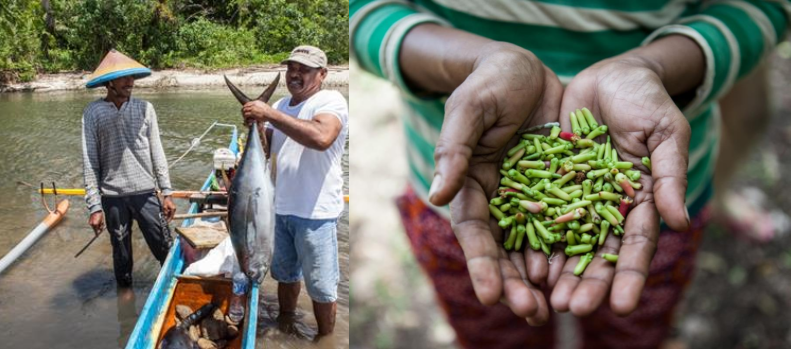
Climate Field School (CFS) is one of BMKG yearly program has been established since 2007 until present day. In general, the CFS objective is to anticipate climate extreme by improving the farmers insight of BMKG’s climate & weather information and use the information for agriculture activity. In the early days, the CFS is focusing on rice farming. Rice is the majority of Indonesian main source of food. Therefore, the productivity & stability of rice production is one of the government of Indonesia’s main concern. However, in 2016, Ministry of Agriculture recorded from 8.2 million hectare of wetland, the ratio between irrigated and non-irrigated (mostly rain-fed) paddy field (wetland) is: 6:4. Its mean that there are 3.4 million hectare of wetland still depend on rain-fed as the main source of water.
Author: admin
Strengthening Climate & Weather Information Services to improve resilience
One of the important tasks of the Climate Change Adaptation and Resilience Program – or abbreviated as APIK – is to help BMKG in strengthening Weather and Climate Information Services, so that it can be fully utilized by the Indonesian people in general, as well as communities in East Java, Southeast Sulawesi and Maluku in particular. We believe that the improvement of weather and climate information services, is one of the most important components in increasing the resilience of communities in facing the threat of climate change. The resilience needs to be built at the level of institutional resilience, socio-economic resilience and landscape-based resilience, and to be built at the National Government level, Local Government, private sector, and Community level resilience.
Continue reading Strengthening Climate & Weather Information Services to improve resilience
Vulnerability Assessment Upstream Brantas
Almost all of Malang City, Batu City, Malang District, and Blitar District form part of the Brantas Watershed. Those four areas are all considered one landscape, i.e. upstream Brantas, and as a result several strategic factors are interrelated. Economically, this landscape contributes 13.83% of East Java GRDP. Due to many factors, these four cities and districts are significantly impacted by climate change and disaster events with the potential for this to get worse in the future. Therefore, it was important to carry out the vulnerability and risk assessment in one integrated approach. Similarly, many of the solutions and strategies to address the risks cross administrative boundaries.
Vulnerability Assessment Maluku Province
The climate vulnerability and risk assessment (VA) in Maluku Province was developed to strengthen regional resilience to climate risks and hydrometeorological hazards and as the basis for formulating the regional climate adaptation strategy. This study can also be used as input for more responsive and adaptive development planning in Maluku.
Marine Weather Information for Fisherfolk Training Module
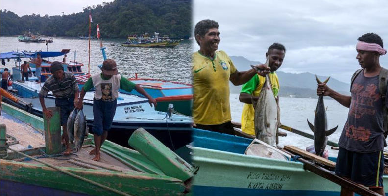
APIK bekerjasama dengan Badan Meteorologi Klimatologi dan Geofisika (BMKG) pusat dan daerah, Kementerian Kelautan dan Perikanan (KKP), serta The International Federation of Red Cross and Red Crescent Societies (IFRC) bermaksud untuk menyelenggarakan Pelatihan Informasi Cuaca Maritim untuk Nelayan di desa Tambakrejo, Kabupaten Blitar. Pelatihan ini bertujuan untuk memberikan pengetahuan terkait layanan informasi cuaca maritim dari BMKG dan informasi terkait prakiraan lokasi ikan (PPDPI) yang berasal dari Kementerian Kelautan dan Perikanan (KKP). Pelatihan dibuat sebagai upaya pembentukan materi informasi cuaca maritim hingga ke level komunitas. Pada akhirnya diharapkan adanya peningkatan pemahaman berbagai komunitas terhadap informasi cuaca maritime serta dampaknya bagi kehidupan, sehingga dapat menentukan sikap serta mengambil keputusan yang tepat sebagai upaya adaptasi terhadap dinamika cuaca maritim.
Continue reading Marine Weather Information for Fisherfolk Training Module
Climate & Weather Information Services Assessment Report
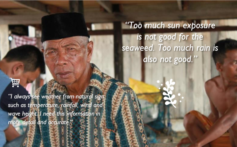
Climate and weather information (CWI) services are used by a wide range of actors in Indonesia—public, private, and civil society—to fulfill specific, placed-based needs, from maximizing crop yields to navigating coastal waters to warning communities of impending flood risk. Recent advances in technology enable meteorologists to capture larger quantities of more precise weather data, while community leaders, farmers, and fisher folk increasingly have access to that data via mobile connectivity. Nevertheless, the CWI services marketplace remains quite fragmented with varying levels of coordination along the ‘value chain’ of service provision that collects raw data and translates it into useful information for beneficiaries.
Continue reading Climate & Weather Information Services Assessment Report
Climate & Weather Information Services Roadmap
Read Full Report here: APIK CWIS Roadmap
Climate and weather information services (CWIS) are used by a wide range of actors in Indonesia—public, private, and civil society—to fulfill specific, placed-based needs, from maximizing crop yields to navigating coastal waters to warning communities of impending flood risk. Recent advances in technology enable meteorologists to capture larger quantities of more precise weather data, while mobile and internet-based communications are steadily (albeit disparately based on location) allowing more and more community leaders, farmers, and fisher folk to access real-time weather updates. Nevertheless, the CWIS “marketplace” remains quite fragmented with varying levels of coordination along the “value chain” of service provision that collects raw data, translates it into information useful for decision-makers, and, ultimately, leads to tangible socioeconomic and security benefits at the community level.
Continue reading Climate & Weather Information Services Roadmap
APIK Profile Video
The 1st step in answering the gap of climate & weather information services to build resilience
Weather and climate information services are one of the prerequisites for building resilience to climate change at the local government and community level. For regional decision makers, climate information needs to be a strong scientific base in planning and taking medium and long-term development decisions.
Vulnerability Assessment Downstream Brantas
The years 2015 and 2016 are listed by the World Meteorological Organization as the hottest years in the last hundred years. Extreme weather events, floods and landslides are becoming more frequent. The risks of climate change and disasters are faced by all levels of society in Brantas water shed; but the communities that will most likely feel the impact are: farmers, fishermen, and the urban poor. The impacts of climate change can reduce development outcomes, threaten food security, and increase poverty. Most of the disasters that occur in Brantas water shed are related to climate and weather (hydrometeorological disaster).
Continue reading Vulnerability Assessment Downstream Brantas


