Vulnerability Assessment Landscape Kendari & Konawe Selatan

The climate vulnerability and risk assessment (VA) in the landscape of Kendari City and South Konawe District was developed as a basis for the climate adaptation strategy and strengthening landscape resilience to climate risks and hydrometeorological hazards. This study can also be used as an input for further site selection to strengthen community resilience to climate change and
disaster.

Continue reading Vulnerability Assessment Landscape Kendari & Konawe Selatan

Vulnerability Assessment Landscape Lease Islands

The years 2015 and 2016 are listed by the World Meteorological Organization as the hottest years in the last hundred years. Extreme weather events, floods and landslides are becoming more frequent. The risks of climate change and disasters are faced by all levels of society in Ambon and Lease islands; but the communities that will most likely feel the impact are: farmers, fishermen, and the urban poor. The impacts of climate change can reduce development outcomes, threaten food security, and increase poverty.

Continue reading Vulnerability Assessment Landscape Lease Islands

Downscaling Climate Projections for Maluku Islands

Author:
I DewaGedeA. Junnaedhi, M.Si
Dr. NurjanaJokoTrilaksono

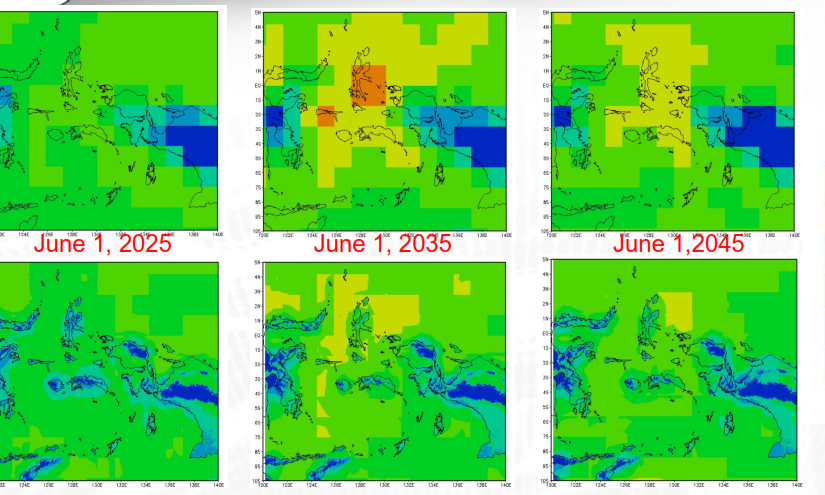
The objective of this activity is to provide downscaled-climate change data over Maluku Island and surrounding area using statistical downscaling method with following variables: Mean temperature (T), Minimum temperature (Tmean), Maximum temperature (Tm), Precipitation (Pr), and Area: 10 °S to 5 °N; 120°E to 140 °E.

This product is developed to support Vulnerability Assessment for Maluku Province and Landscape (Lease Islands).

Continue reading Downscaling Climate Projections for Maluku Islands